FJD Trion™ P1 LiDAR Scanner

Relative Accuracy Up to 2 cm*

Scanning Range 40 m @ 10% reflectivity

LiDAR FOV 360° × 59°

Points Per Second 200,000

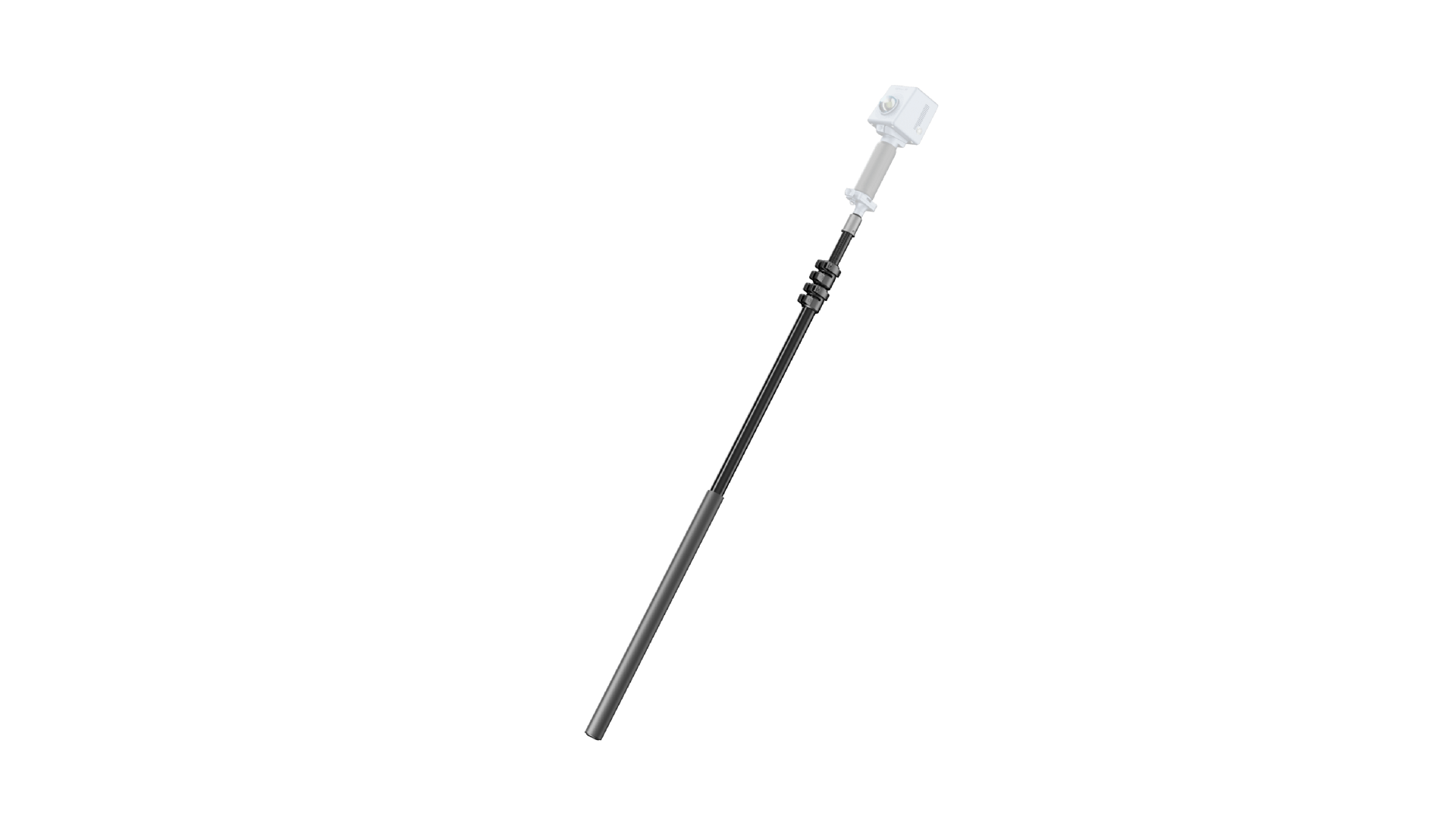
Lightweight and Portable 1 kg / 2.2 lbs

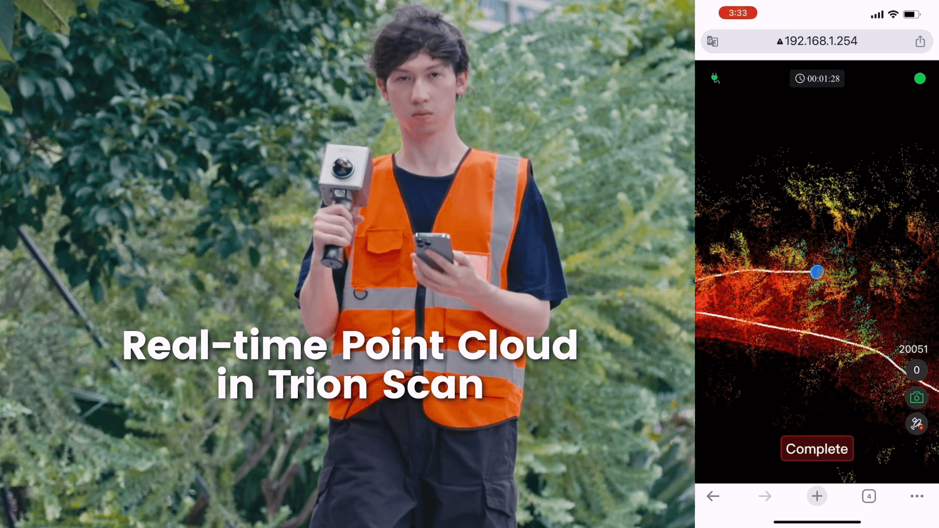
Real-time Point Cloud Visualize as you scan
Easy Reality Capture
Whether you are a seasoned laser scanning professional or just 3D-curious, a walk around the site with the P1 lets you digitize your environment quickly and accurately.
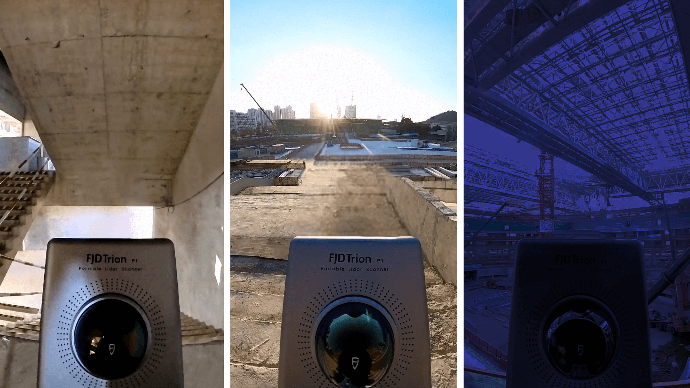
Indoor, Outdoor, Underground, all Day Long
Wherever you go, the P1 can capture what you see. Map the environment with intricate details inside and outside, from ornate architecture to hidden infrastructure, from forensic evidence to urban vegetation analysis. Powerful SLAM technology enables the P1 to work in direct sunlight or even at night, in locations that may be inaccessible with traditional methods.
Compact Yet Mighty
Pick up the FJD Trion P1 whenever you want to take a closer look at your world. Weighing in at only 1 kg or slightly over 2 lbs, the P1 fits in a messenger bag and can work all day with easy battery swaps, recreating your environment in minutes.

From scan to deliverable: a full workflow
Walk and scan with the P1, while viewing the real-time point cloud data on your mobile device via Trion Scan. Check for data completeness and note the loop closure numbers to ensure enough data is captured for proper post-processing.
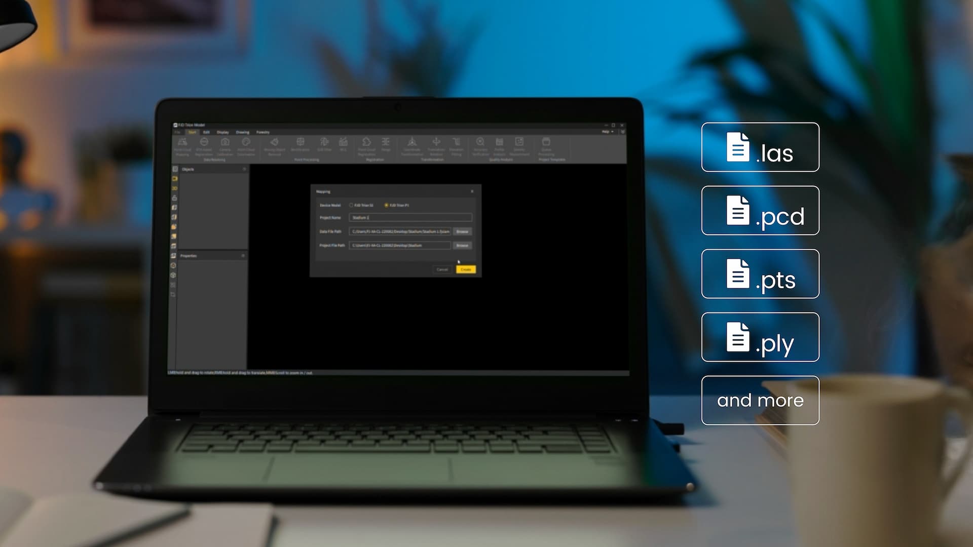
The P1 produces universal point cloud data formats in las, pcd, pts, ply. Download and import the field data into Trion Model or a compatible third party software program to classify, register, and calculate point cloud data for your specific application. Scan to post-processing time ratio is about 3:1.
Save time and labor on fieldwork. Eliminate rework and errors that come with manual measurements. Keep your teams focused on the most valuable tasks, and offer new services and deliverables to your clients to grow your business.

Seamless Integration into FJD Trion Software Ecosystem
Streamline the workflow from point cloud capture, data processing, to deliverable sharing, giving you a smooth project experience.
Data collection
Real-time app control. Scan file management


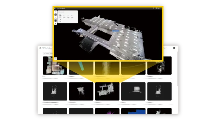
Generate Deliverables
iPad and Android support, on-site post-processing and preview

Application Scenarios

Property Management and Assessment
Assess structural integrity, plan spaces, and identify areas in need of repair or renovation. Reduce uncertainty in investment decisions with insights from a rich spatial dataset.

Public Safety
Leverage point cloud data to enhance disaster preparedness and recovery plans. Quickly record evidence and crime or accident scenes for immediate and accurate forensic documentation.

Architecture, Engineering and Construction
Make more informed decisions on your projects from blueprint to QA/QC with building surveys, scan to CAD&BIM, as-built documentation, floor plans, and stockpile volumes.

Media and Entertainment
Craft new realities based on real-world inspirations. Whether you're creating video games, virtual tours, or cinematic environments, capture the essence of both indoor and outdoor settings.
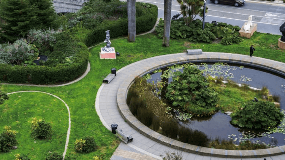
Forestry and Vegetation Analysis
Manage and monitor tree inventory with a quick walk in the forest. Measure crowns, analyze breast diameter and tree height using precise point cloud data.
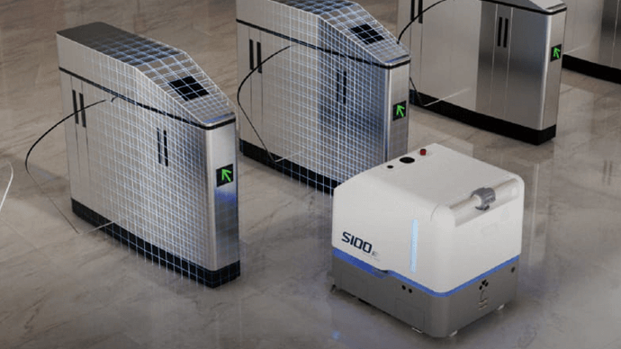
Robotics
Facilitate communications between teams before and during robotics deployment. Plan routes and enhance robot obstacle avoidance with 2D maps and 3D models of the environment.
Multiple Configurations
Integrate the P1 into your workflow to maximize efficiency in data capture.
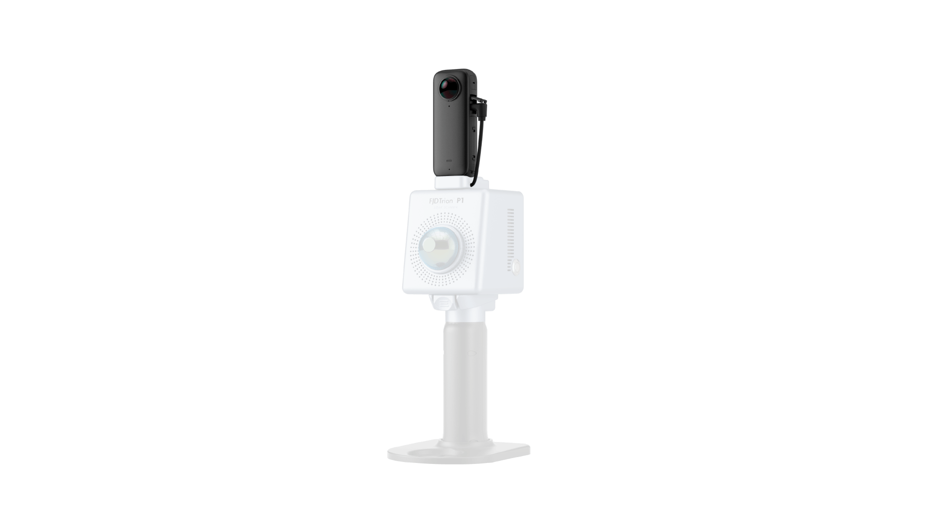
Capture RGB videos with the panoramic camera.
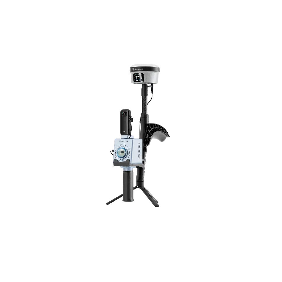
Generate georeferenced point cloud data.
Map spaces that are hard to reach
Create your FJD Trion plan
Our solutions support different field based workflows across construction, forestry, mining, inspection, mapping, public safety, and more. The product combination depends on how your team works today and where time or money is being lost.
If you share your project type, current workflow, and main challenge, our experts can provide you with an FJD Trion solution tailored for your team. Need a free consultation or demo? Contact Us
