Where mining and quarrying workflows lose time and confidence

Changing Surfaces Are Reduced to Incomplete Measurements
Stockpiles, quarry faces, tunnel sections, and excavation areas change continuously, but many records are still built from isolated points, manual estimates, or simplified geometric assumptions. The resulting number may not fully represent the surface the team is actually managing.
Risky Field Access Puts People Too Close to Hazards
Manual checks and repeated equipment setup can keep several people in the field for longer than necessary. Crews may need to climb loose stockpiles or work near unstable slopes, underground traffic, unsupported areas, or active machinery simply to collect the measurements the operation needs.
Volume Differences and Excavation Deviations Surface Too Late
Inventory gaps, over-excavation, under-excavation, and section deviations become harder to resolve after material has moved or the next production stage has begun. By then, the issue can affect reconciliation, contractor settlement, rework, material use, and schedule decisions.
One 3D record for measurement, change tracking, and reporting
Connect field capture, point cloud processing, mine mapping, quantity calculation, section comparison, and report output in one coordinated workflow built around measurable site data.
One 3D record for measurement, change tracking, and reporting
Connect field capture, point cloud processing, mine mapping, quantity calculation, section comparison, and report output in one coordinated workflow built around measurable site data.
See the mine take shape in data
95%
Less Measurement Time
+50%
Reduction in Field Personnel
500m³/min
Stockpile Capture
900m²/min
Coal Pile Capture
Estimated performance is based on selected FJD Trion configurations, internal workflow comparisons, and customer-reported experience. Actual results vary with project scope, site conditions, machine type, crew experience, design readiness, accuracy requirements, and the workflow being replaced.
One workflow from site capture to measurable evidence
Use one coordinated process to define the measurement target, capture the real surface, and prepare the point cloud. Then run the required analysis and produce a result the wider project team can review.

1. Define the Measurement Target
Confirm whether the job involves open-pit terrain, quarry material, a stockpile, tunnel section, drift, roadway, or excavation area. Plan a safe route and identify any required control points, design axes, reference profiles, boundaries, or comparison dates before field capture begins.

2. Capture Site Conditions
Use the FJD Trion S2 or FJD Trion P2 to record the target as a high-density point cloud. Scan around a stockpile from suitable positions, or move along the tunnel or excavation path to capture the actual surface and section geometry.

3. 3. Process and Prepare the Point Cloud
Import the captured data into FJD Trion Model for registration, cleaning, clipping, and model preparation. Remove surrounding objects and unnecessary areas so the working dataset focuses on the stockpile, quarry material, or excavation section being measured.
4. 4. Calculate Volume or Compare Sections
For stockpiles, define the material boundary and calculate volume, footprint, surface area, height, or cut-and-fill quantities. For underground work, generate actual cross-sections and compare them with the design axis or reference profile to locate over-excavated, under-excavated, and aligned areas.


3. 5. Generate the Report and Keep the Record
Export the required measurements, 2D mine plans, analysis views, and visual evidence as a standardized project record. When conditions change, capture the new area and add it to the existing dataset so later reviews build on the same site record.
導入後
FJD Trionにより、チームは複雑な条件にも対応し、各階を5〜10分でスキャンし、センチメートルレベルのBIM出力を実現しました。これにより、現実の状況とデジタルモデルの整合性がさらに高まりました。
“FJD Trionのおかげで、密集して複雑なプラント環境でも、はるかに高い確信を持って作業を進めることができました。各階を数分でスキャンし、実際の現場条件にはるかに忠実なBIM出力を作成できました。”
プロジェクトチーム、浄水処理プラント
香港
導入前
密集した水処理施設では、従来の測量では取得に時間がかかり、手作業での調整も増え、詳細の見落としリスクも高くなるため、プロジェクト遂行の効率が低下し、高額な手戻りが発生する可能性も高まっていました。
Build a mine record that keeps up with the site
Choose the capture and software tools that fit the site, then keep the same mine record moving through processing, measurement, analysis, review, and future updates.
Capture Large and Complex Mine Sites
FJD Trion S2
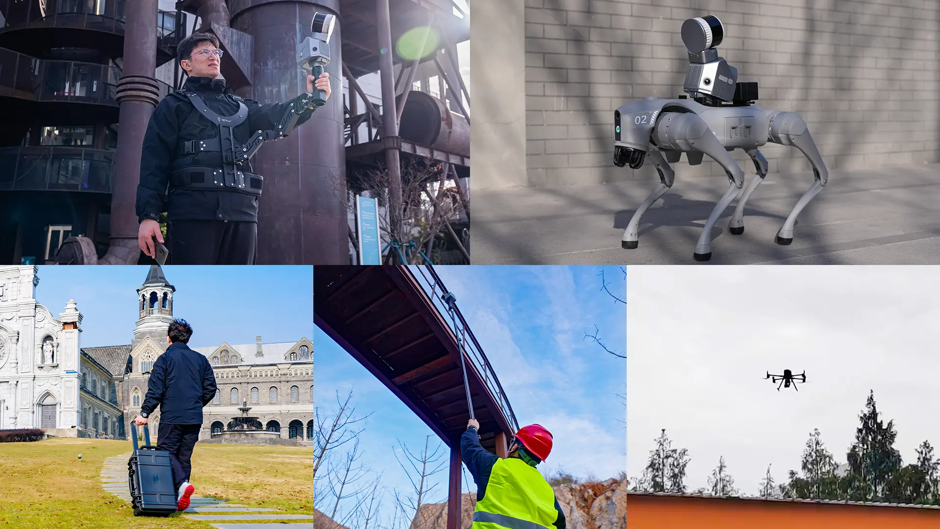
FJD Trion S2 captures stockpiles, quarry surfaces, excavation areas, and underground sections as detailed 3D data. Integrated GNSS and multi-SLAM processing support georeferenced point clouds across open and GNSS-constrained environments, giving survey and operations teams a shared record of site conditions.


Carry Portable Capture into the Measurement Area
FJD Trion P2
FJD Trion P2 provides portable 3D LiDAR capture for stockpile, aggregate, tunnel, drift, and excavation-section measurement. Teams can follow a planned route around or through the target area and leave the field with a dense point cloud ready for downstream analysis.
Turn the Point Cloud into Quantities and Profiles
FJD Trion Model
FJD Trion Model prepares captured point cloud data for measurement and analysis. Teams can isolate the target area, calculate volume and surface information, generate profiles and cross-sections, compare site geometry, and produce the visual outputs required for operational review.
Keep Mine Data Accessible Beyond the Processing Desk
FJD Trion Model Web
Upload point cloud and mesh projects to a browser-based workspace for viewing, measurement, project management, and data sharing. Operations, survey teams, clients, and remote stakeholders can return to the same digital mine record without requiring every reviewer to use desktop processing software.
Where the Workflow Earns Its Keep
Stockpile Inventory and Volume Calculation
Quarry Aggregate Measurement
Underground Mine Mapping
Underground Cross-Section Analysis
Over- and Under-Excavation Control
Mine Change Monitoring
Build the right measurement workflow for your mine or quarry
Tell us what you need to measure - stockpile volume, aggregate inventory, tunnel sections, excavation deviation, or project evidence. An FJD Trion specialist will review your current process and recommend the right capture and processing setup for your operation.
Get a project-specific recommendation based on your site, measurement frequency, required outputs, access conditions, and existing workflow.
Need a free consultation or demo? Talk to a mining and quarrying workflow specialist
Frequently asked questions
Learn how 3D LiDAR scanning, point cloud processing, stockpile volume calculation, underground cross-section analysis, and traceable reporting fit into mining and quarrying workflows.
A stockpile can be captured as a 3D point cloud, isolated from its surroundings, and measured against a defined base or boundary. FJD Trion S2 and FJD Trion P2 capture the surface, while FJD Trion Model prepares the data for volume, footprint, surface-area, height, and cut-and-fill analysis.
A LiDAR scanner records the visible surface of the pile as millions of spatial points while the operator follows a planned route around it. The resulting point cloud preserves the pile's irregular geometry so the software can calculate quantities from the captured surface rather than from a simplified shape.
Yes. SLAM-based LiDAR capture can record tunnels, drifts, roadways, and underground excavation areas where continuous GNSS positioning may not be available. FJD Trion scanners capture the section geometry, and FJD Trion Model prepares the point cloud for profile and cross-section analysis.
Underground cross-section analysis creates actual profiles from captured point cloud data and compares them with a design axis or reference section. The comparison shows where the excavation is over-excavated, under-excavated, or aligned with the expected profile.
The captured point cloud records the actual excavation geometry. By generating sections and comparing them with the approved design or reference profile in FJD Trion Model, teams can locate deviations earlier. The visual comparison then supports quality review and corrective planning.
LiDAR scanning can reduce the need to climb loose stockpiles or place workers directly on irregular material. The operator can plan a capture route from suitable positions around the pile, although the site's own risk assessment, exclusion zones, traffic controls, and safety procedures still apply.
Depending on the task and processing setup, a mining point cloud can support volume, footprint, surface area, height, contours, and cut-and-fill quantities. It can also support 2D mine plans, cross-sections, design-profile comparisons, change records, and visual project documentation. Define the required deliverable before capture so the field route and control strategy support the analysis.
A typical workflow combines a 3D LiDAR scanner for site capture with point cloud software for cleaning, measurement, analysis, and reporting. FJD Trion can configure the workflow around S2 or P2 capture and FJD Trion Model processing. FJD Trion Model Web can then support browser-based viewing, measurement, project access, and data sharing, depending on the required workflow.
Start with the measurement target, site size, indoor or outdoor conditions, required coordinate system, capture frequency, and final deliverable. FJD Trion can then recommend the appropriate scanner, positioning setup, processing workflow, and reporting method for your operation.
