
全球測位衛星コンステレーション
1408チャンネル対応

H≤0.8 cm+1 ppm
V≤1.5 cm+1 ppm

内蔵IMU
最大30°の傾斜測量

レーザー測定
精度 @3m≤3cm

ポケットサイズ
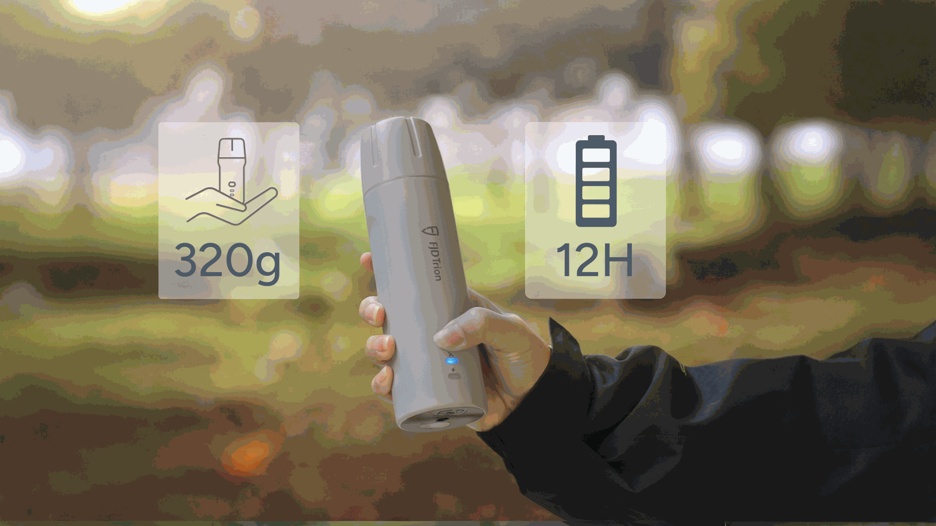
わずか320g

バッテリー駆動時間 ≥12時間
充電時間 ≤3時間

1.2m
耐落下

起動時間
コールド: ≤30秒、ホット: ≤5秒,
RTK初期化: <5秒
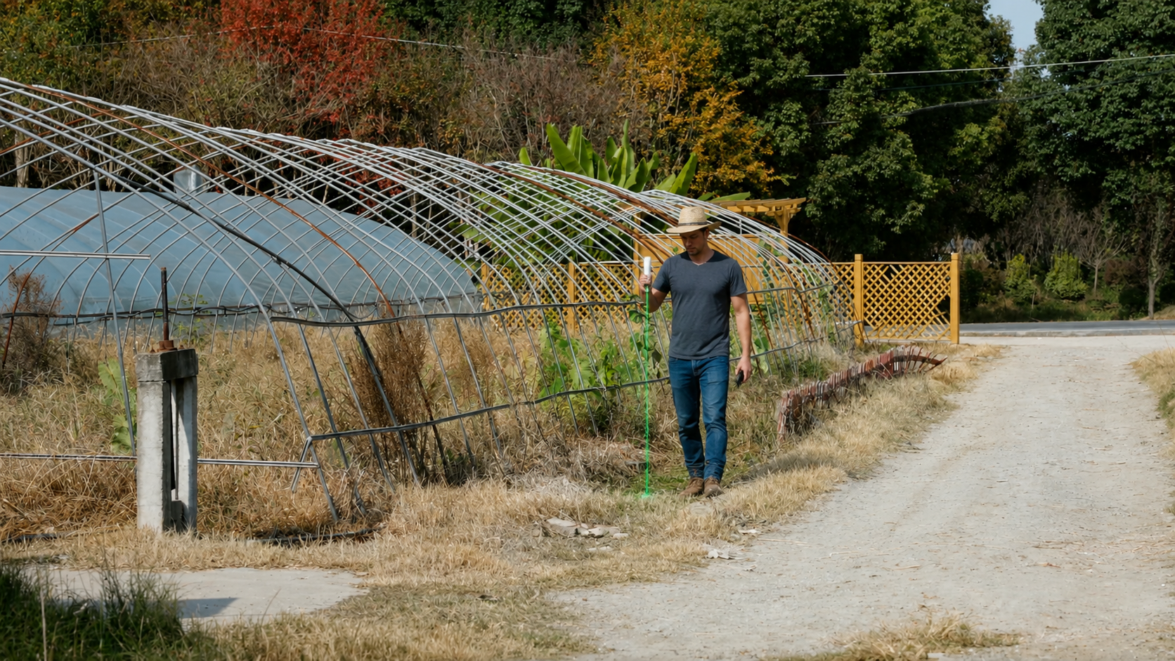
ポール不要、心配無用
まだポールの設置に手間取り、扱いにくい角度に苦労し、測定値に自信が持てずにいませんか? FJD Trion V4e Pro は、日々の現場作業における煩わしさを取り除くために設計されています。 厳しい条件下でも、ポイントして測定し、自信を持って次へ進めます。追加のセットアップも、慎重な姿勢も、繰り返しの確認も不要です。
選ばれる理由
ポイントするだけ、
あとはV4e Proにおまかせ
持ち運び、設置、位置調整のためのポールは不要です。最大60°の角度でも、±3.5 cmの精度で、ポイントするだけで正確な座標を取得できます。
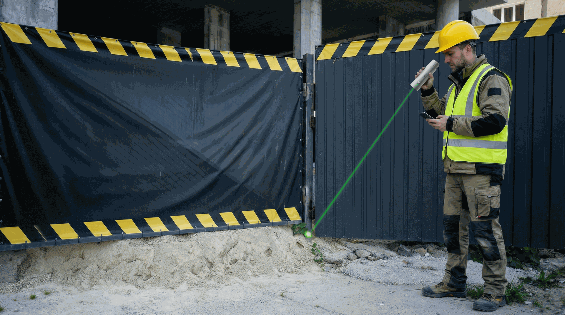
毎回確実にターゲットへ
レーザーをオンにして、緑色のビームに従って杭打ちポイントへ進むだけ。ターゲットに到達した瞬間に、システムが位置を確認します。
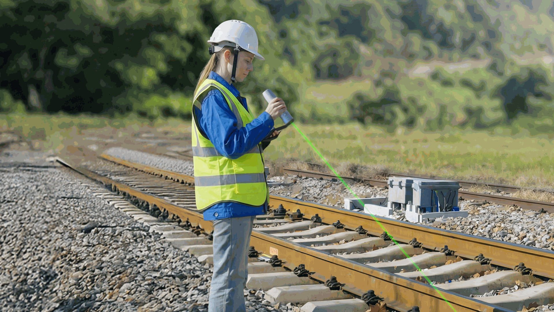
アクセスしにくい場所のために設計
近づきにくい場所も、その場に立ったまま測定。対象物に物理的にアクセスしなくても、立っている位置から狙って測れます。
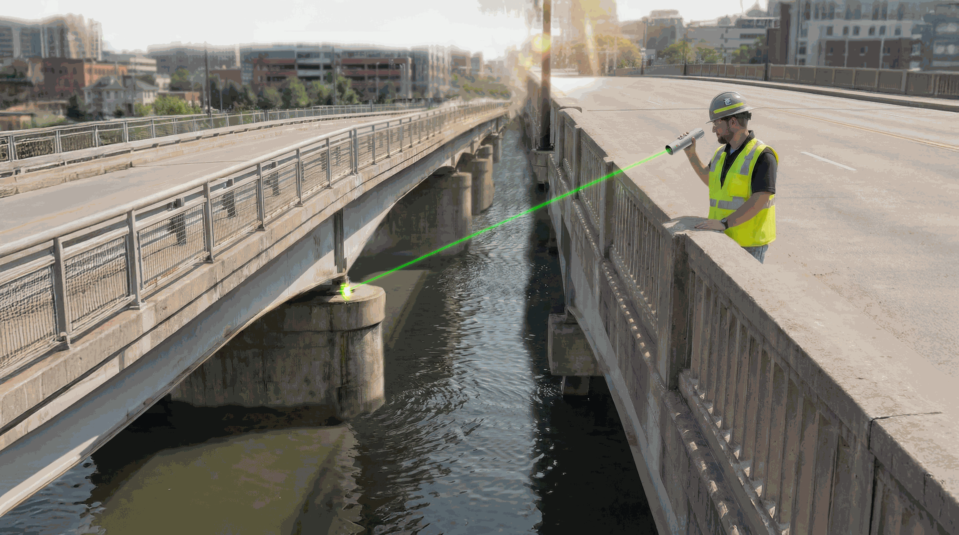
日光下でも視認可能
明るいグリーンレーザーは日光下でもはっきり見えるため、素早く照準を合わせ、自信を持ってポイントを確認できます。
すぐに持ち出せる
一日中持ち運べる軽さと、現場で頼れるパワーを両立。わずか320gの軽量設計で、最大12時間稼働し、3時間未満で再充電可能。さらに、現場での1.2mの落下にも耐えます。
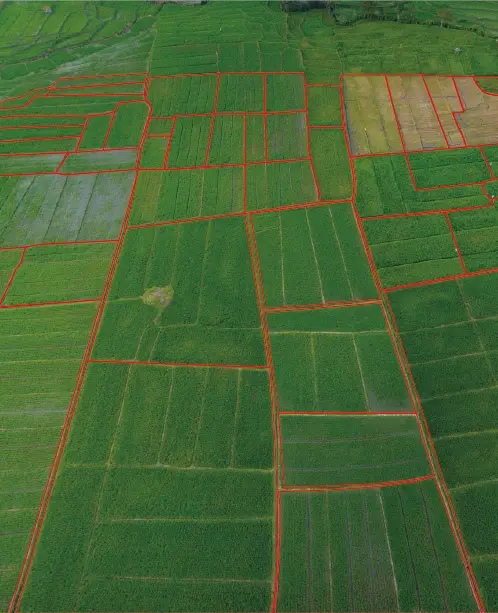
あらゆる分野で発揮される高精度
V4eは、農業ワークフローに信頼性の高いGNSS 測位をもたらします。FieldFusion と組み合わせて使用することで、圃場データの収集や境界管理を行えます。


どこでも、正確な作業をサポート

地形測量

道路測量
林業 & 農業

建設 & BIM
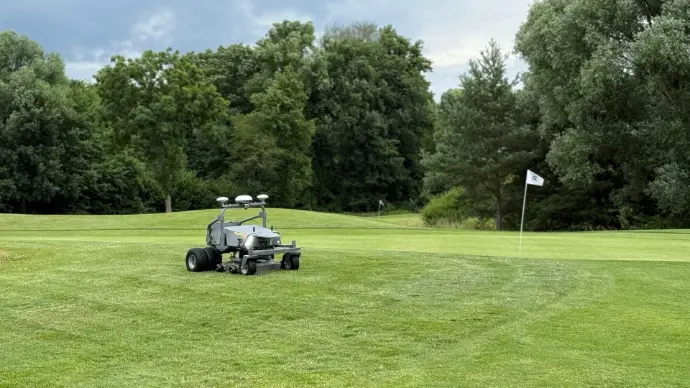
迅速な ロボティック統合
公益事業 & 公共工事
V4e & V4e Pro 仕様

衛星システム
BDS(北斗)
B1I, B2I, B3I, B1C, B2a, B2b*
GPS
L1 C/A, L2P, L5
GLONASS
G1、G2
Galileo
E1、E5a、E5b、E6*
QZSS
L1、L2、L5
SBAS
L1 C/A
チャンネル数
1408
*対応ファームウェアバージョンは近日提供予定
*対応ファームウェアバージョンは近日提供予定
データタイプ
差分データ形式
RTCM 2.3、RTCM 3.x、CMR
出力データ形式
NMEA-0183
精度と信頼性
信号再捕捉時間
≤ 1 秒
初回測位時間(TTFF)
コールドスタート:≤30 秒、ホットスタート:≤ 5 秒
GNSS 初期化時間
< 5 秒
初期化データ信頼性
> 99.9%
データ更新レート
測定・測位:
1 Hz、2 Hz、5 Hz、10 Hz、 20 Hz
単独測位解精度 (RMS)
H ≤ 1.5 m、V ≤ 2.5 m
DGPS (RMS)
H ≤ 0.4 m、V≤ 0.8 m
GNSS (RMS)
H ≤ 0.8 cm + 1 ppm、V ≤1 .5 cm + 1 ppm
時刻精度 (RMS)
20 ns
速度精度 (RMS)
0.03 m/s
レーザー傾斜測定精度 (V4e Pro)
≤
3 m距離で3 cm誤差
(θ ≤ 30°)
(θ ≤ 30°)
傾斜測定精度 (V4e Pro)
3D誤差 ≤ 2.5 cm (θ ≤ 30°)
3D誤差 ≤ 3.5 cm (θ ≤ 60°)
3D誤差 ≤ 3.5 cm (θ ≤ 60°)
電気およびインターフェース仕様
充電仕様
5V/2A
消費電力
≤ 1.5 W
電気インターフェース
USB 2.0 Type-C
充電時間
≤ 3 時間
物理的特性
筐体材質
PC+ABS
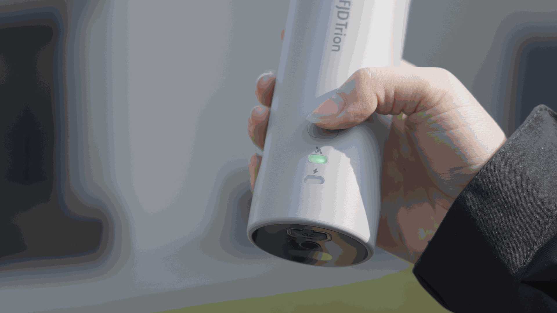
ボタン
電源オン/オフ
動作温度
-20℃~60℃
寸法
182 x 53 x 53 mm
取付インターフェース
1/4インチねじ内部インターフェース
インジケーターライト
固定式分解 & 充電
充電温度
0℃~45℃
通信
BT 4.0
デュアルモード
動作距離:5 m
Wi-Fi(ベースステーションモード)
2.4 G
動作距離:5 m(ベースステーションプロトコル)
