Where interior design workflows lose time and context
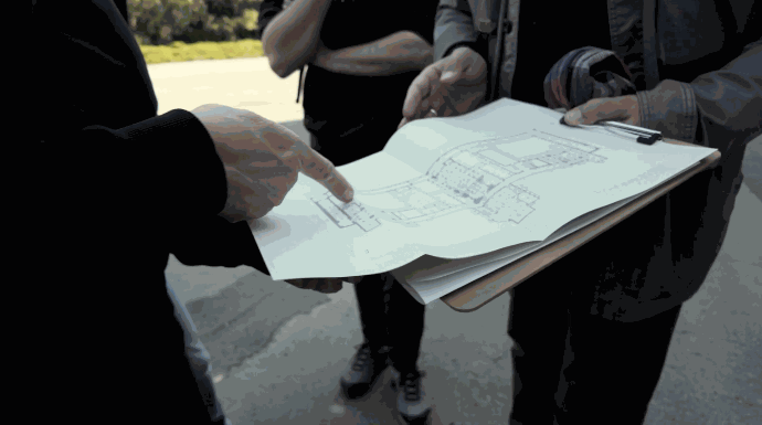
Manual site measures capture pieces instead of the whole space
Dimensions are recorded one at a time, while photographs, sketches and notes carry the remaining context. The team leaves with selected measurements rather than a complete spatial record it can revisit.
Missing details send the team back
A forgotten opening, ceiling height or surrounding dimension may not become obvious until planning or modelling has begun. Work stops while someone checks old photographs or returns to the site.
The people designing the project do not always see the same site
Projects move between surveyors, designers, visualisers, contractors and clients. When each person interprets separate files, important spatial relationships become harder to communicate.
Keep existing conditions, design decisions and project communication connected
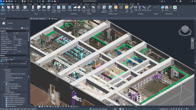
A connected interior design workflow keeps the captured space available from the first site visit through planning, review and presentation. FJD Trion brings indoor LiDAR capture, onsite checking, floor plan generation, point cloud processing and 3D visualisation into one coordinated process.

One workflow from existing space to design-ready context
Connect site capture, floor plan creation, 3D project review and visual communication in one workflow built around the real space.
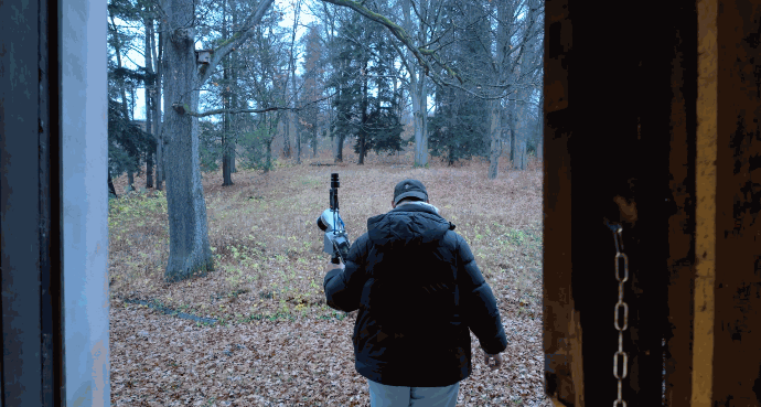
1. Capture the existing interior
Walk through the space with FJD Trion C1 or V4e Go. Record rooms, walls, openings, ceilings, fixed elements and surrounding context without measuring every feature individually.
C1 provides a focused indoor floor plan workflow. V4e Go supports broader point cloud capture when the project needs richer 3D context or extends outdoors.
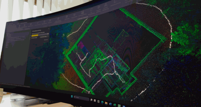
2. Check the site record before leaving
Watch the space take shape as you scan. Identify gaps, revisit missed areas and review the captured result while the site is still available.
With C1 and the Creative app, add laser measurements and check critical dimensions. With V4e Go and FJD Trion Scan, review the developing point cloud before processing.
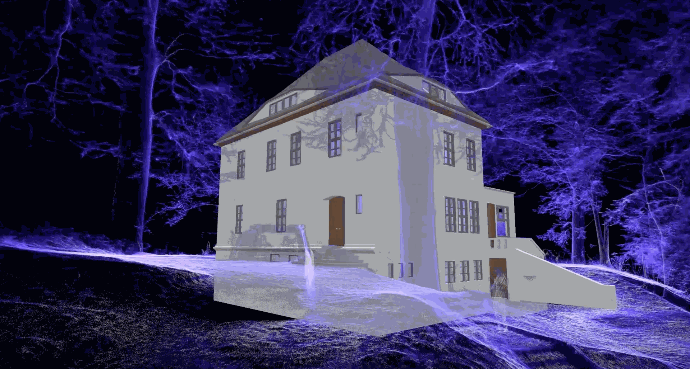
3. Process the capture in the cloud
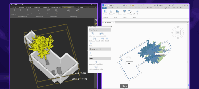
Upload compatible projects to Creative Portal for floor plan refinement. Keep the 3D mesh visible while adjusting walls, doors, windows and room boundaries.
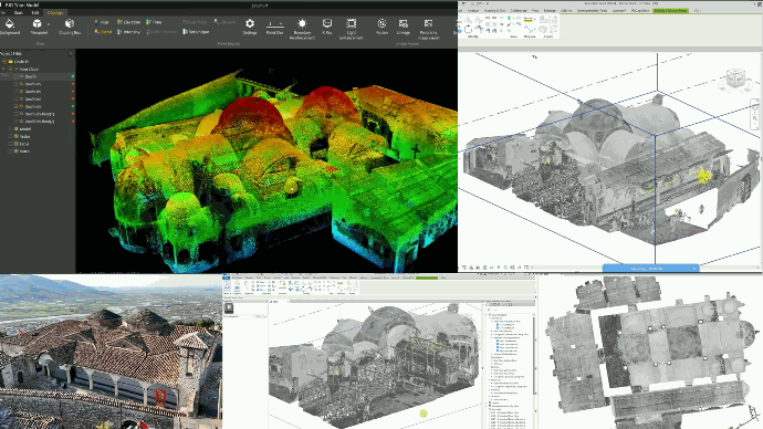
For broader 3D workflows, move V4e Go projects into Model Web to process, view and measure scan data in the browser.
4. Create the project deliverables
Generate the output required for the next design stage: editable DXF floor plans, PDF reports, 2D plan graphics, measurable point clouds or 3D models.
Selected workflows also support GLB or OBJ models, 3DGS experiences and AI-generated interior renderings.
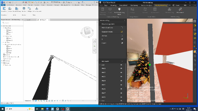
5. Process the capture in the cloud
Use the floor plan and 3D record for space planning, renovation decisions, design review and client presentation.
Return to the captured site when questions arise and preserve the existing conditions as the project moves forward.
After
With FJD Trion, the team adapted to complex conditions, scanned each level in 5 to 10 minutes, and achieved centimeter-level BIM output, enabling stronger alignment between real-world conditions and the digital model.
“FJD Trion helped us move through a dense and complex plant environment with much greater confidence. We were able to scan each level in minutes and produce BIM output that aligned far more closely with real site conditions.”
Project Team, Water Treatment Plant
Hong Kong
Before
In a dense water treatment facility, traditional surveying meant slower capture, more manual coordination, and a higher risk of missed details, making project execution less efficient and increasing the chance of costly rework.
One workflow from existing space to design-ready context
Connect site capture, floor plan creation, 3D project review and visual communication in one workflow built around the real space.
Capture the Exact Site Conditions
FJD Trion C1
S2 Max captures the operating area as detailed 3D data. It records the boundaries, surfaces and physical features needed to create a digital representation of the site before routes, work zones or robotic tasks are defined.


Anchor the Digital Site to the Real World
FJD Trion V4e Go
V4e Pro provides the GNSS positioning reference that connects captured site data to its physical location. This keeps the digital map, planned task and robot’s operating area aligned within the same real-world coordinate system.
Capture the Exact Site Conditions
FJD Trion Creative App
S2 Max captures the operating area as detailed 3D data. It records the boundaries, surfaces and physical features needed to create a digital representation of the site before routes, work zones or robotic tasks are defined.
Anchor the Digital Site to the Real World
FJD Trion Creative Portal
V4e Pro provides the GNSS positioning reference that connects captured site data to its physical location. This keeps the digital map, planned task and robot’s operating area aligned within the same real-world coordinate system.
Capture the Exact Site Conditions
FJD Trion Scan
S2 Max captures the operating area as detailed 3D data. It records the boundaries, surfaces and physical features needed to create a digital representation of the site before routes, work zones or robotic tasks are defined.
Anchor the Digital Site to the Real World
FJD Trion Model Web
V4e Pro provides the GNSS positioning reference that connects captured site data to its physical location. This keeps the digital map, planned task and robot’s operating area aligned within the same real-world coordinate system.
Solutions for every type of interior project
Residential Interior Design
Capture apartments and houses before developing room layouts, furniture plans, lighting concepts, material selections, and full interior redesigns.
Renovation and Remodeling
Document the existing space before demolition or construction begins. Create reliable references for design planning, budgeting, contractor coordination, and progress records.
Kitchen and Bathroom Design
Record walls, openings, ceiling heights, fixtures, and irregular geometry before planning cabinetry, surfaces, appliances, plumbing, and installation.
Commercial Fit-Out
Capture offices, retail stores, restaurants, and other commercial interiors to support space planning, refurbishment, and coordination between different teams.
Hospitality Interiors
Document hotels, restaurants, and guest spaces for renovation planning, design updates, furniture layouts, and visual presentation.
Property Documentation
Create measured floor plans and digital records for property management, leasing, renovation proposals, and future maintenance or redesign.
Explore the complete Scan-to-CAD workflow
Need to turn captured interior conditions into editable technical drawings? Click to explore the FJD Trion Scan-to-CAD workflow to see how point cloud data moves from on-site capture to CAD-ready plans and project deliverables.
Build the right workflow for your interior projects
Tell us what you capture, how your team currently measures interiors and which deliverables move the project forward. Get a recommendation based on your spaces, project volume, accuracy requirements and existing design workflow.
Need a free consultation or demo? Talk to an interior design specialist
Frequently asked questions
Learn how indoor reality capture, floor plan generation, point cloud processing and 3D visualisation fit together.
3D scanning records walls, floors, ceilings, openings, fixed elements and room relationships as digital spatial data. Teams can use the result to prepare floor plans and 3D models, check measurements, plan layouts, document existing conditions and communicate the space.
C1 is purpose-built for indoor floor plan capture and includes built-in laser measurement. V4e Go captures broader indoor and outdoor point clouds and supports either the Creative workflow or Model Web, depending on the required deliverables.
Use C1 with Creative Portal when the main job is capturing interiors and creating editable floor plans. V4e Go can also use the Creative workflow when a floor plan is the main output but the project needs a different capture configuration.
Use Model Web when the project needs point cloud processing, browser-based measurement or 3D model generation. It also supports 3DGS visualisation, rendered interior concepts and broader project sharing.
Yes. The mobile workflow lets users monitor the capture and identify areas that need more coverage while still onsite. C1 also allows users to add laser measurements and check critical dimensions through the Creative app.
Creative Portal supports GLB, DXF, SVG, PNG, JPG and PDF exports. Teams can continue floor plan work, preserve 3D data or use image and PDF formats for documentation and presentation.
Model Web supports DXF and PDF floor plans, OBJ 3D models and AI-generated interior renderings. It also supports point cloud viewing and measurement, data sharing, 3DGS visualisation and virtual room walkthroughs.
Reality capture preserves more spatial context than isolated measurements, but critical dimensions should still be checked against the project’s requirements and tolerances. C1 includes a built-in laser measurement tool for verifying key dimensions onsite.
Start with the type and size of spaces you capture and the number of projects completed each month. Then define the required accuracy, tolerance and final deliverables. An FJD Trion specialist can recommend the relevant scanner and software workflow.
