FJD Trion EG10 Excavator Guidance System
FJD Trion EG10 is a wireless excavator guidance system with ±3 cm accuracy.
The modular design allows fast transfer between machines, making it suitable for different jobs and crews.
What Sets It Apart

Global Coordinate Systems
6,000+ predefined coordinate systems worldwide.
Quick setup for different regions, without extra configuration.
Multi-Layer Support
Works with DWG, DXF, SHP, KML, and XML files.
Clear layer display for complex project drawings.

Leveling
Set a target elevation to keep the surface consistent.
Suitable for land leveling, factory sites, and sludge cleanup.
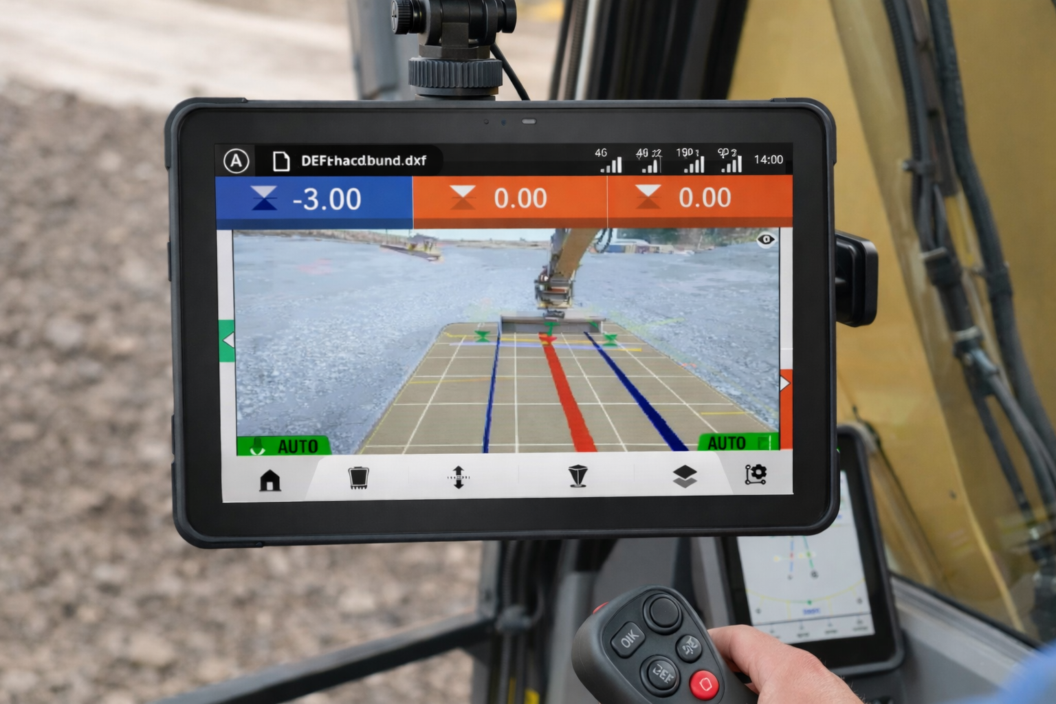
AR Guidance
Overlay design lines and bucket paths on the live camera view.

Line Guidance
Create straight-line elevation guidance in our software.
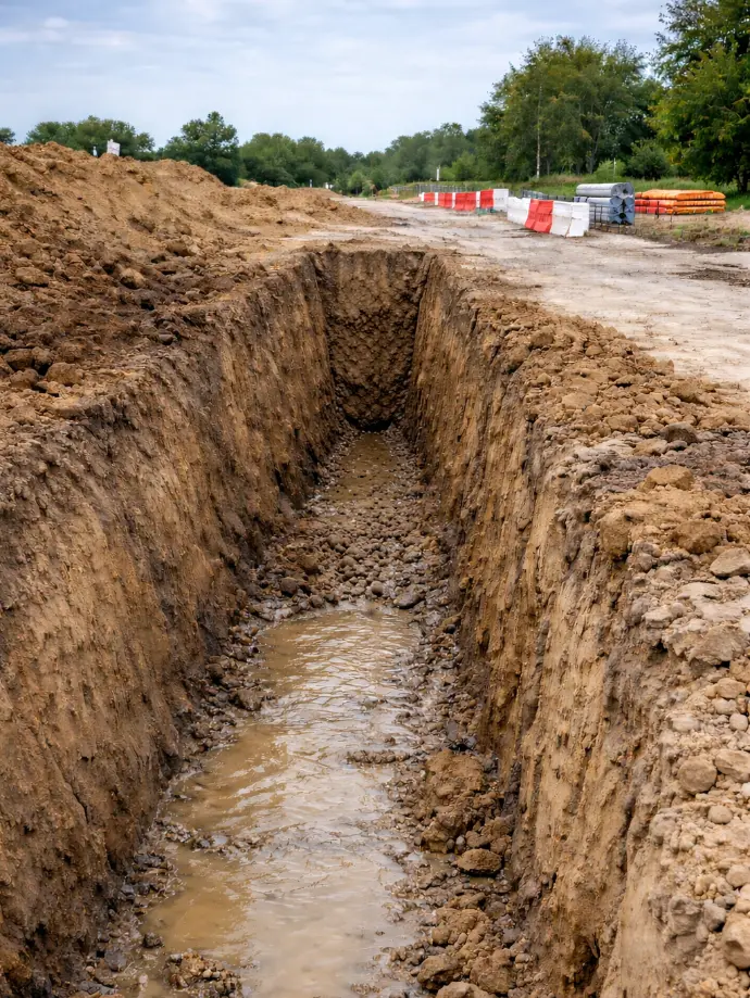
Designed for trenching, slotting, and drainage pipeline work.
Build Slope
Set longitudinal and cross slopes digitally.
Complete slope formation in a single pass for roads and embankments.

Shape the ground with certainty
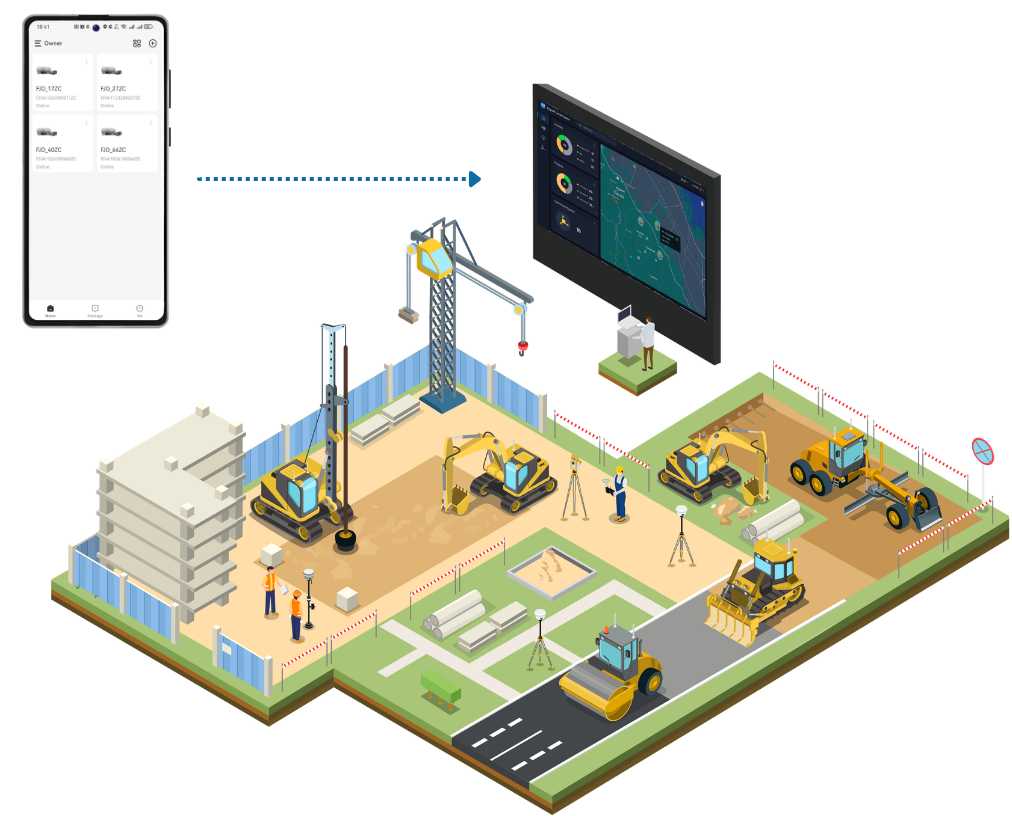
View machine location and status in real time. Support schedule tracking and risk monitoring.
Sync design and field data through the cloud. Keep your office and site workflows aligned.
Helps You Get It Right, Anywhere

Farmland Drainage & Channel Construction
Road Alignment & Drainage Construction

Land Leveling & Field Preparation

Slope & Embankment Construction

Roadbed & Subgrade Construction

Solar PV Pile Layout & Installation
Create your FJD Trion plan
Our solutions support different field based workflows across construction, forestry, mining, inspection, mapping, public safety, and more. The product combination depends on how your team works today and where time or money is being lost.
If you share your project type, current workflow, and main challenge, our experts can provide you with an FJD Trion solution tailored for your team. Need a free consultation or demo? Contact Us
