FJD Trion GNSS Studio

Web-based Platform

Use Across Devices

Digital Reports

Connect Field and Office

Multi-GNSS Support

Easy-to-use Interface
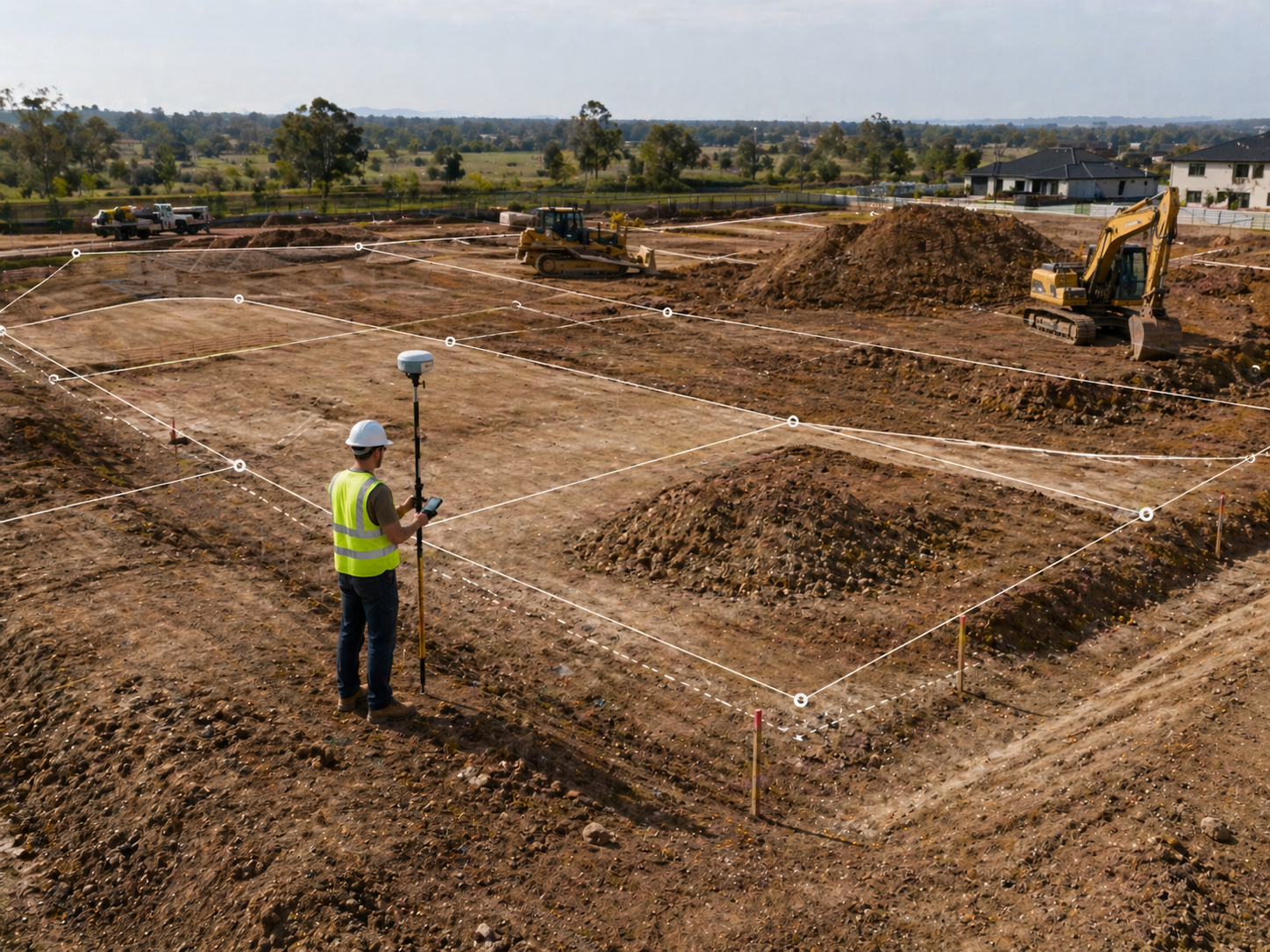
Connect Surveying to Construction
GNSS Studio processes GNSS observation data and delivers accurate control points that serve as the foundation for construction workflows.
By connecting field data with on-site execution, it helps ensure positioning accuracy before work begins.

Manage your projects
Organize GNSS observation files and point data in one place before processing begins. GNSS Studio helps you keep project data clear, complete, and ready for reliable post-processing.
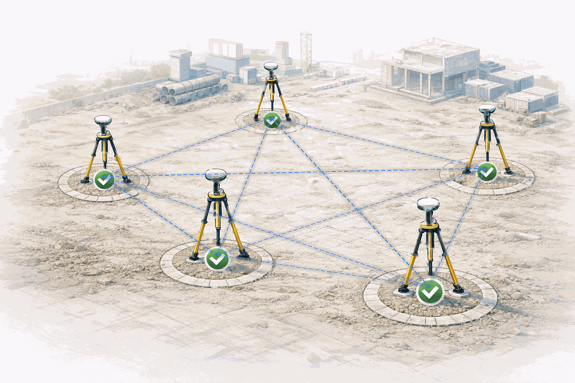
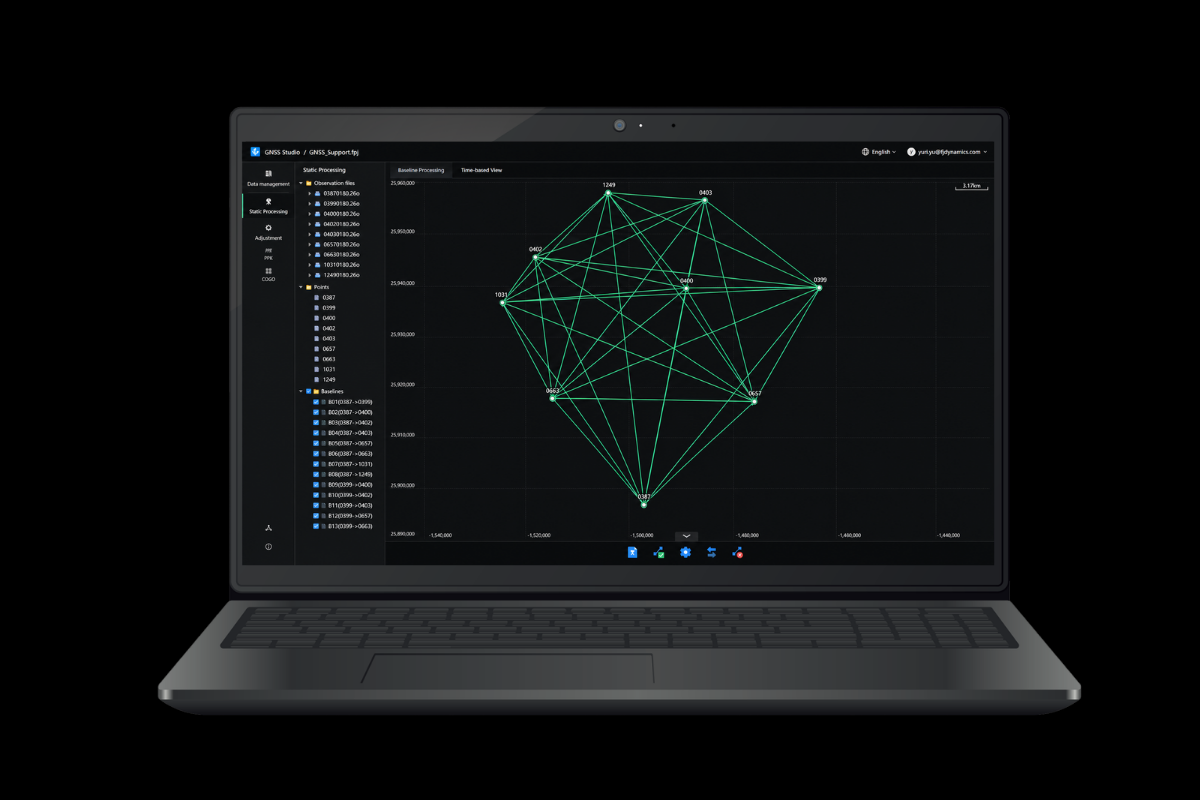
Static Processing for Control Points
Process static survey data to produce high-accuracy control points, forming the positioning reference for construction project.

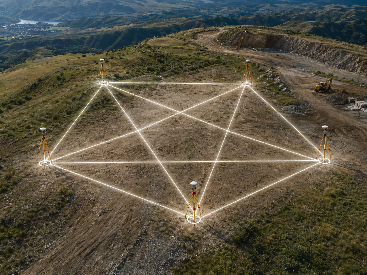
Network Adjustment of Control Points
Combine all baseline results through network adjustment to deliver a consistent and reliable control point framework that can be trusted across the project.
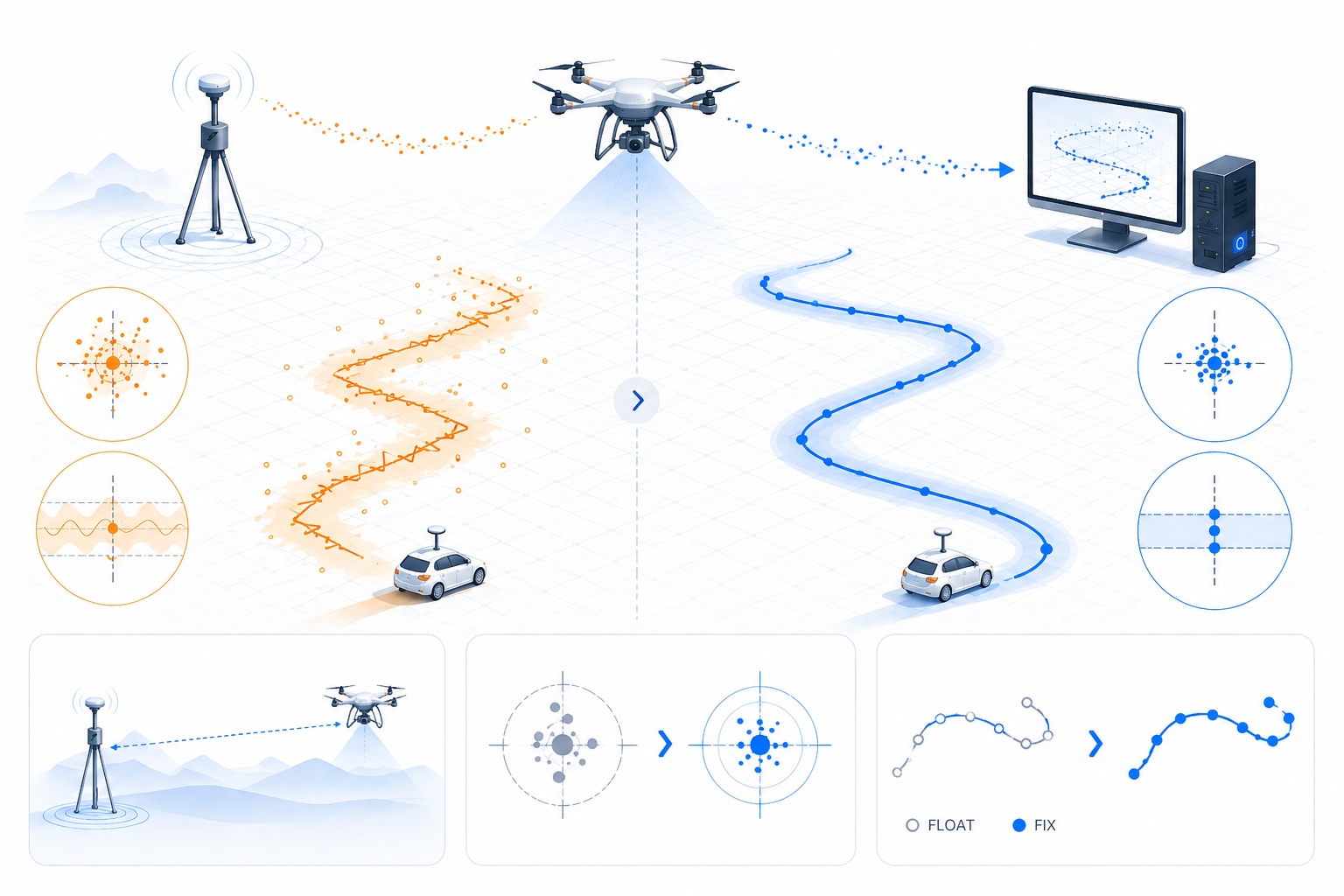
PPK Dynamic Processing
Apply post-processed kinematic (PPK) processing to refine positioning results from moving survey data. GNSS Studio improves the accuracy and continuity of dynamic measurements, delivering clean and reliable paths for on-site work.
Project Setup and Data Preparation Tools
GNSS Studio provides built in tools that help teams clean raw files, configure project coordinates, and verify results before handover.

COGO Calculation Tools
Use calculation tools to check results, and ensure the data is ready before handing it over to the next construction step.

Clean and Prepare Raw Data
Organize, clean, and preprocess raw GNSS observation files before post-processing. GNSS Studio allows you to merge or split files, reduce unnecessary data, decimate points, and perform quality checks.

Match Antennas
Automatically match antenna types, keeping results consistent even when different devices are used across a project.

Coordinate System Setup
Easily configure project coordinates using over 6,000 predefined local coordinate systems. GNSS Studio ensures your results match local project coordinates, minimizing rework before construction.
Helps You Get It Right, Anywhere
Control Point Survey
Build stable control networks with static baseline processing and network adjustment. GNSS Studio delivers the coordinate precision required for engineering control.
Construction Survey
Support construction staking, site control, and field checks with coordinate results. It helps survey teams work with confidence throughout the construction process.
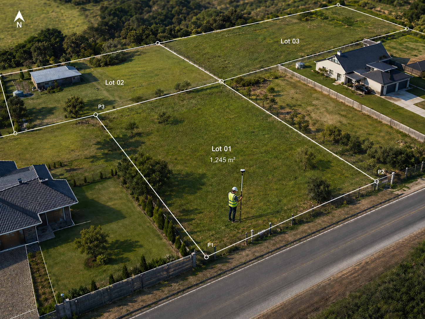
Cadastral Survey
Process parcel boundaries and boundary points collected in the field with the accuracy required for cadastral work. It supports land survey deliverables and boundary data.

UAV PPK Processing
Improve the positioning accuracy of UAV mapping projects with PPK processing for flight trajectory data. GNSS Studio produce accurate geospatial results for aerial surveying.
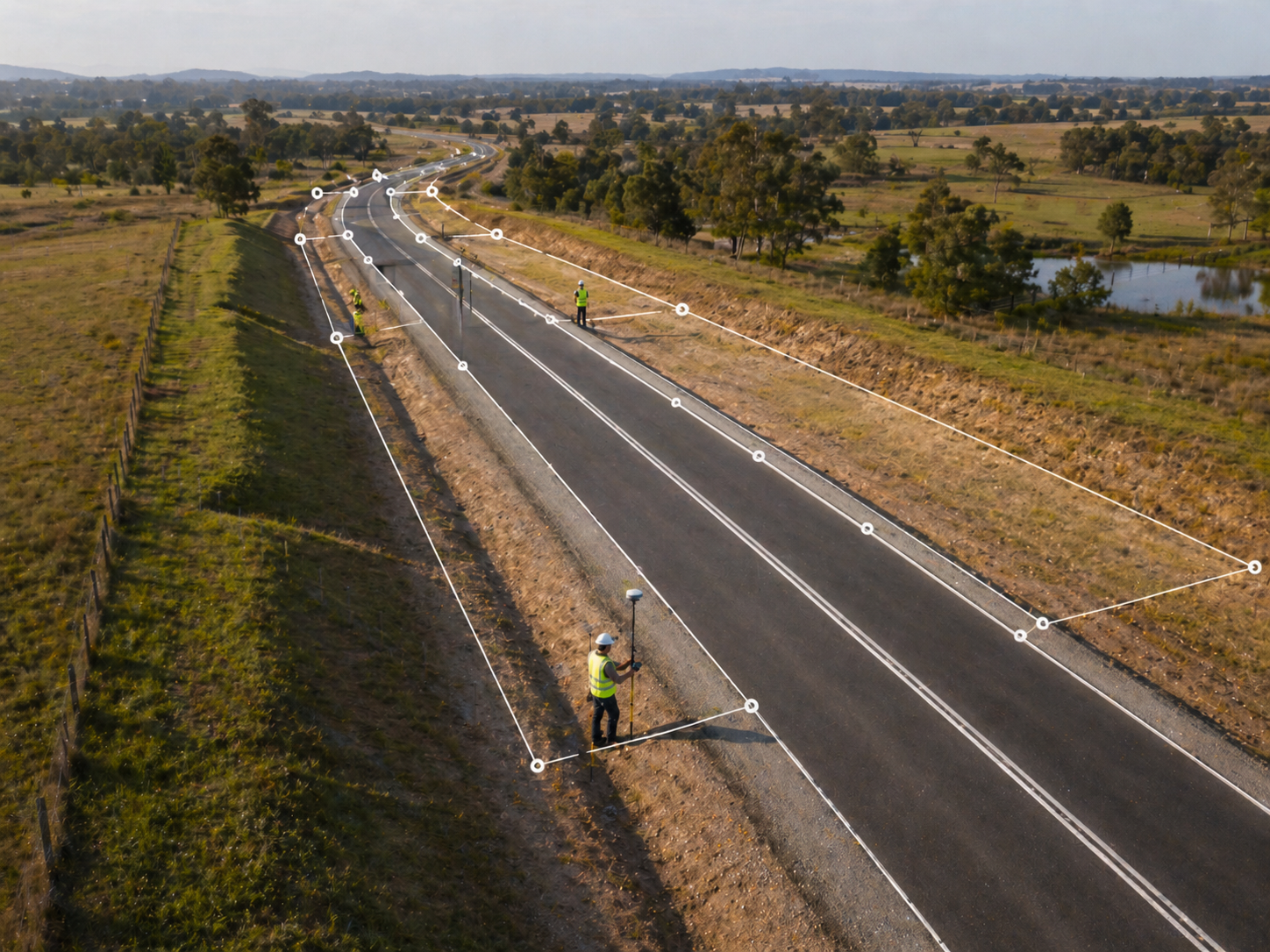
Road & Corridor Survey
Process GNSS data for roads, pipelines, railways, and other linear infrastructure projects. It maintains accuracy and continuity across long corridor surveys.

Mining Survey
Handle topographic and control survey data for mining applications with confidence. Support mine modelling, slope monitoring, and earthwork volume analysis with positioning results.
Create your FJD Trion plan
Our solutions support different field based workflows across construction, forestry, mining, inspection, mapping, public safety, and more. The product combination depends on how your team works today and where time or money is being lost.
If you share your project type, current workflow, and main challenge, our experts can provide you with an FJD Trion solution tailored for your team. Need a free consultation or demo? Contact Us
