Product Comparison
Professional Level
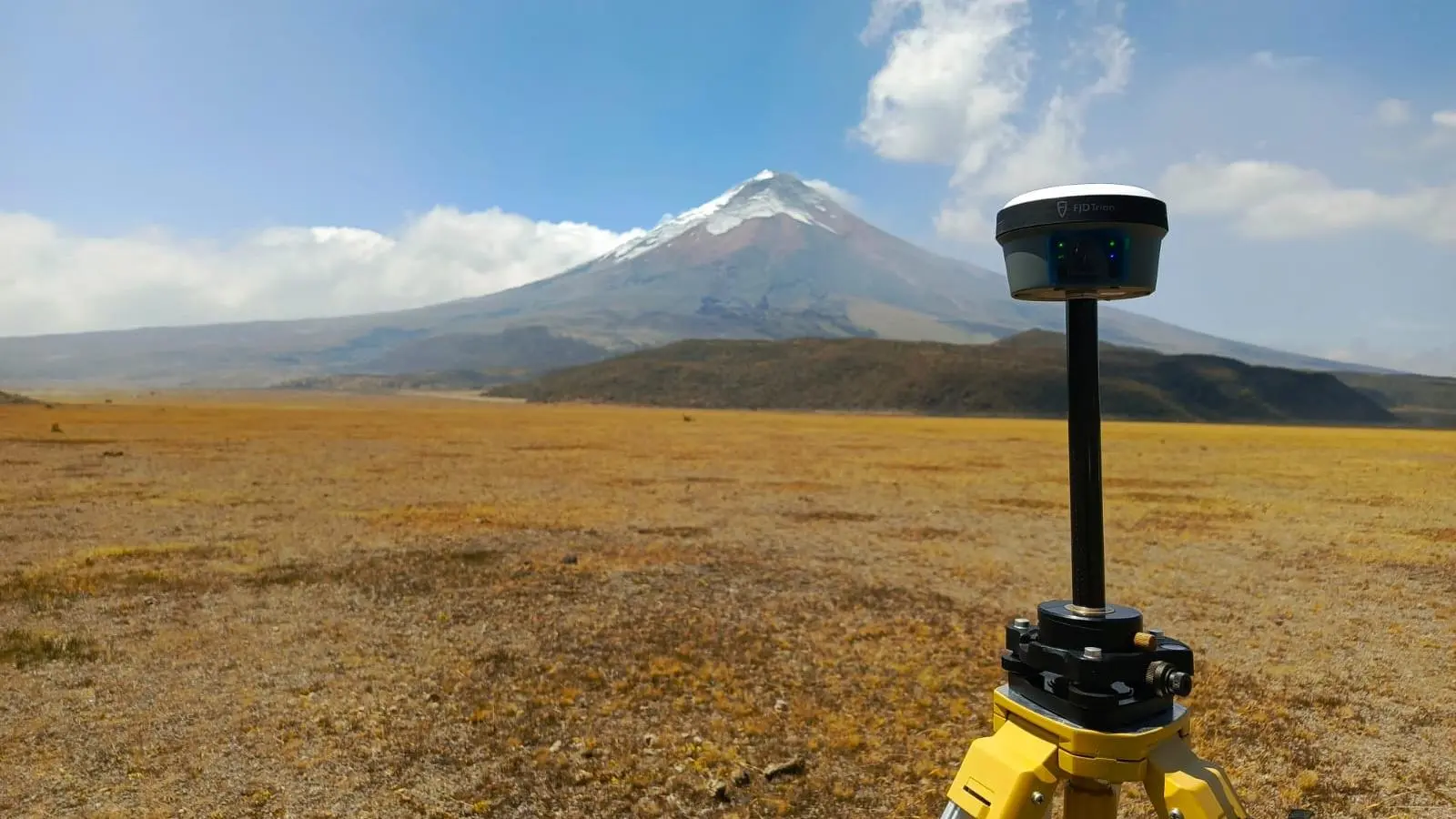
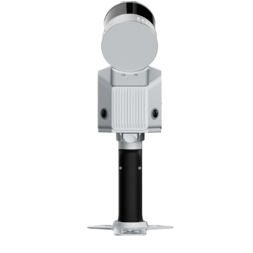
S2 Series LiDAR Scanner
A flagship model designed for professionals, compatible with drones, cars, robot dogs, and other devices.
Professional Level
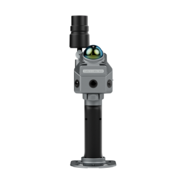
P2 LiDAR Scanner
A budget-friendly model for everyone seeking great features and performance.
Entry Level
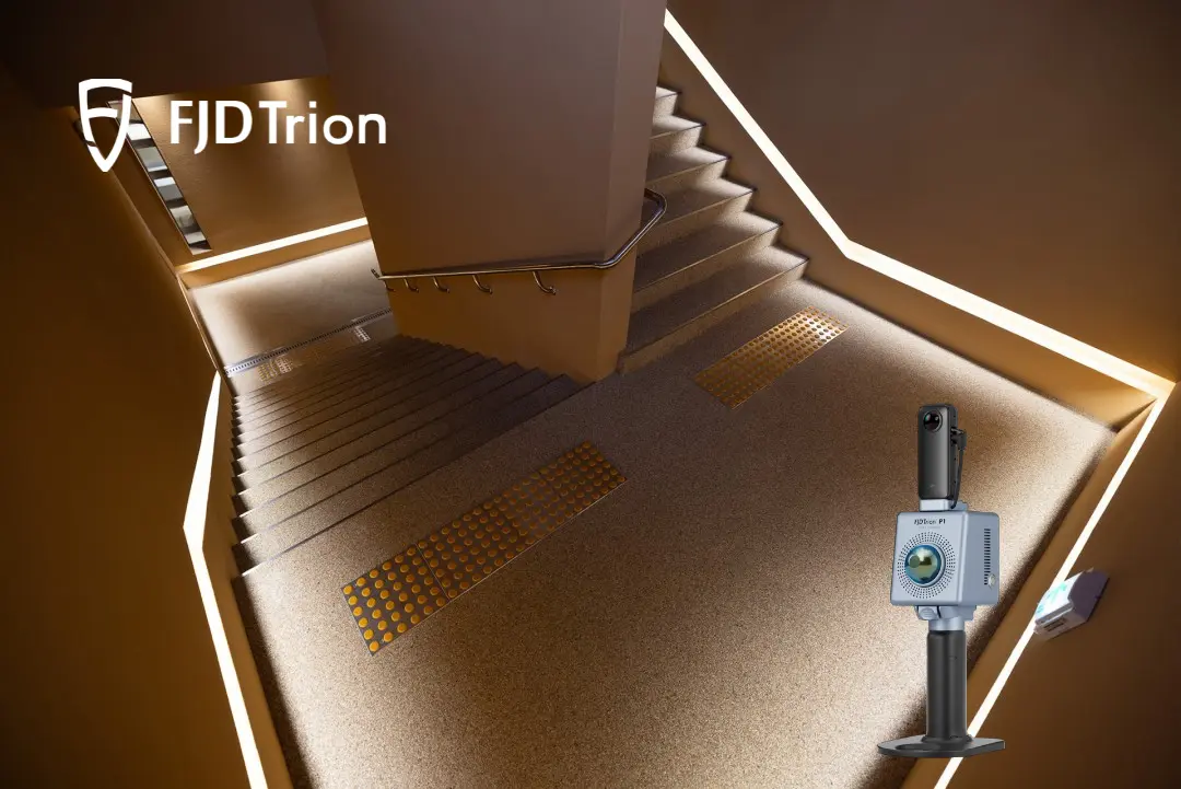
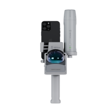
V4e LiDAR Kit
An entry-level handheld scanner that plugs into your phone and instantly records the world.
300m @ 80% reflectivity
Range (S2 MAX)
640,000 pts/s
Speed (S2 MAX)
Relative: 1.2 cm
Absolute: 3 cm
Real-Time Accuracy
Relative: ≤1 cm
Absolute: 3 cm
Post-Processed Accuracy
SLAM+VIO+RTK/PPK
Multi-SLAM
HyperDense+
Real-time Colorization
Georeferenced Point Cloud
3D Gaussian Splatting Supported
Stabilizing Vest / Backpack supported
Rover Pole / Extension Pole supported
Car Mount / Drone Mount / Robot Mount supported
Key Features
70m @ 80% reflectivity
Range
200,000 pts/s
Speed
Relative: 2 cm
Absolute: 5 cm
Real-Time Accuracy
Relative: ≤1 cm
Absolute: 3 cm
Post-Processed Accuracy
SLAM+VIO+RTK/PPK
Multi-SLAM
HyperDense+
Real-time Colorization
Georeferenced Point Cloud
3D Gaussian Splatting Supported
Stabilizing Vest / Backpack supported
Rover Pole / Extension Pole supported
Robot Mount supported
Key Features
50m @ 80% reflectivity
Range
154,600 pts/s
Speed
Relative: 3 cm
Absolute: 5 cm
Real-Time Accuracy
Relative: 1 cm
Absolute: 5 cm
Post-Processed Accuracy
--
Multi-SLAM
HyperDense+
Real-time Colorization
Georeferenced Point Cloud
3D Gaussian Splatting Supported
Up to 5 hours of battery life for work
Key Features
Designed to Work Together
Capture, process, and deliver your 3D data within one connected FJD Trion workflow.
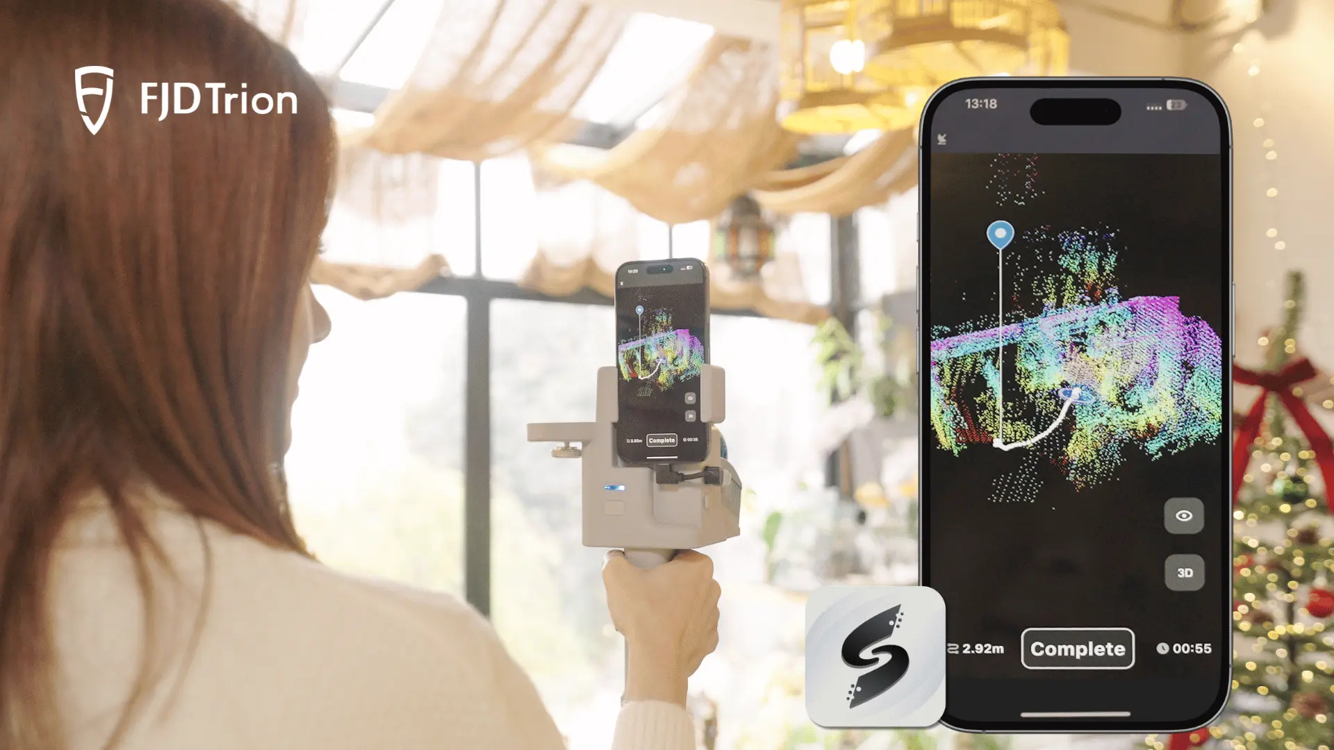
Data collection
FJD Trion Scan
App based real time control and scan file management.


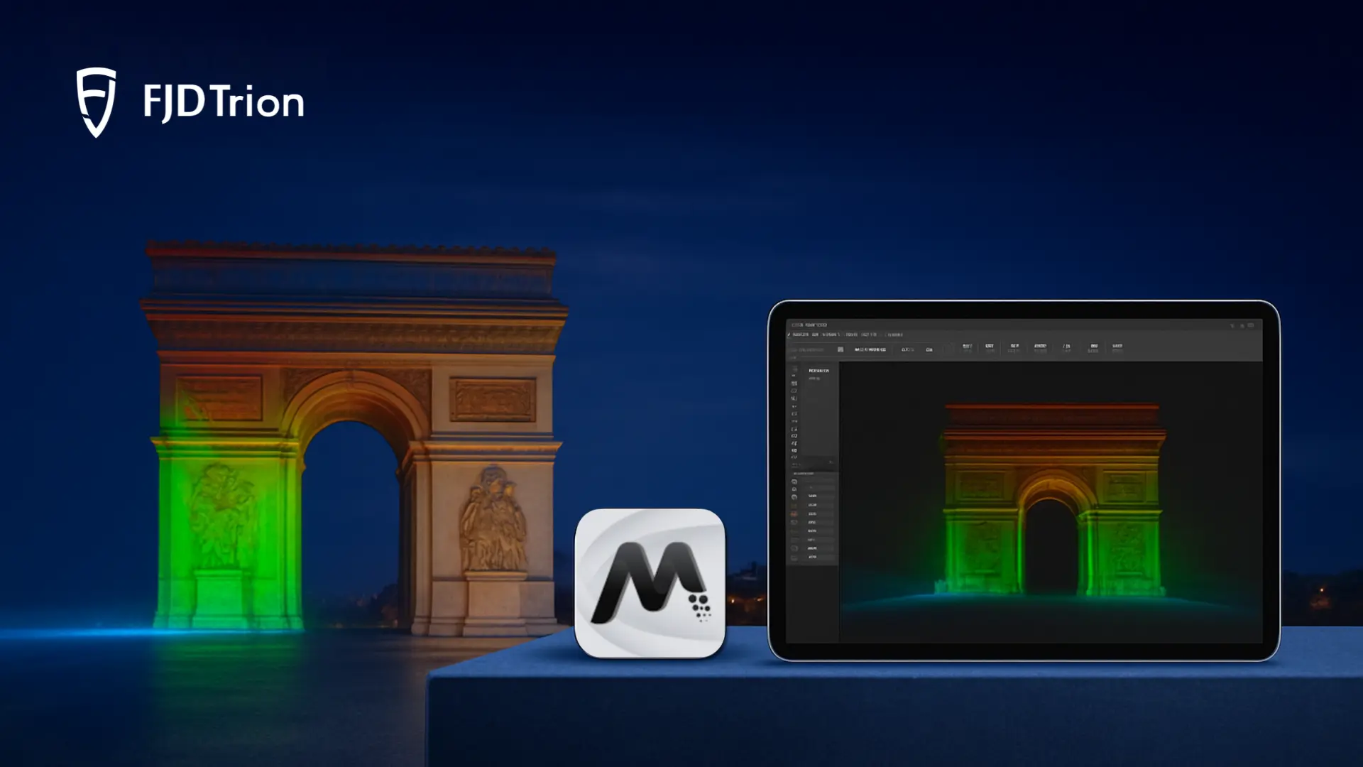
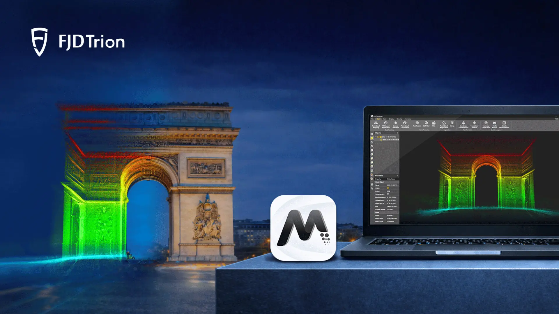
Data processing
FJD Trion Model
Generate reports for construction, forestry, mining, and more.
Download the Latest ProgramGenerate Deliverables
FJD Trion Model for Tablets
On site post processing and preview with iPad and Android support.
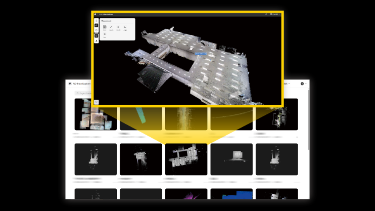
Cloud Collaboration
FJD Trion Model
Share data online and collaborate with basic measurement tools.
Start Free TrialOther product applications