I. New Features
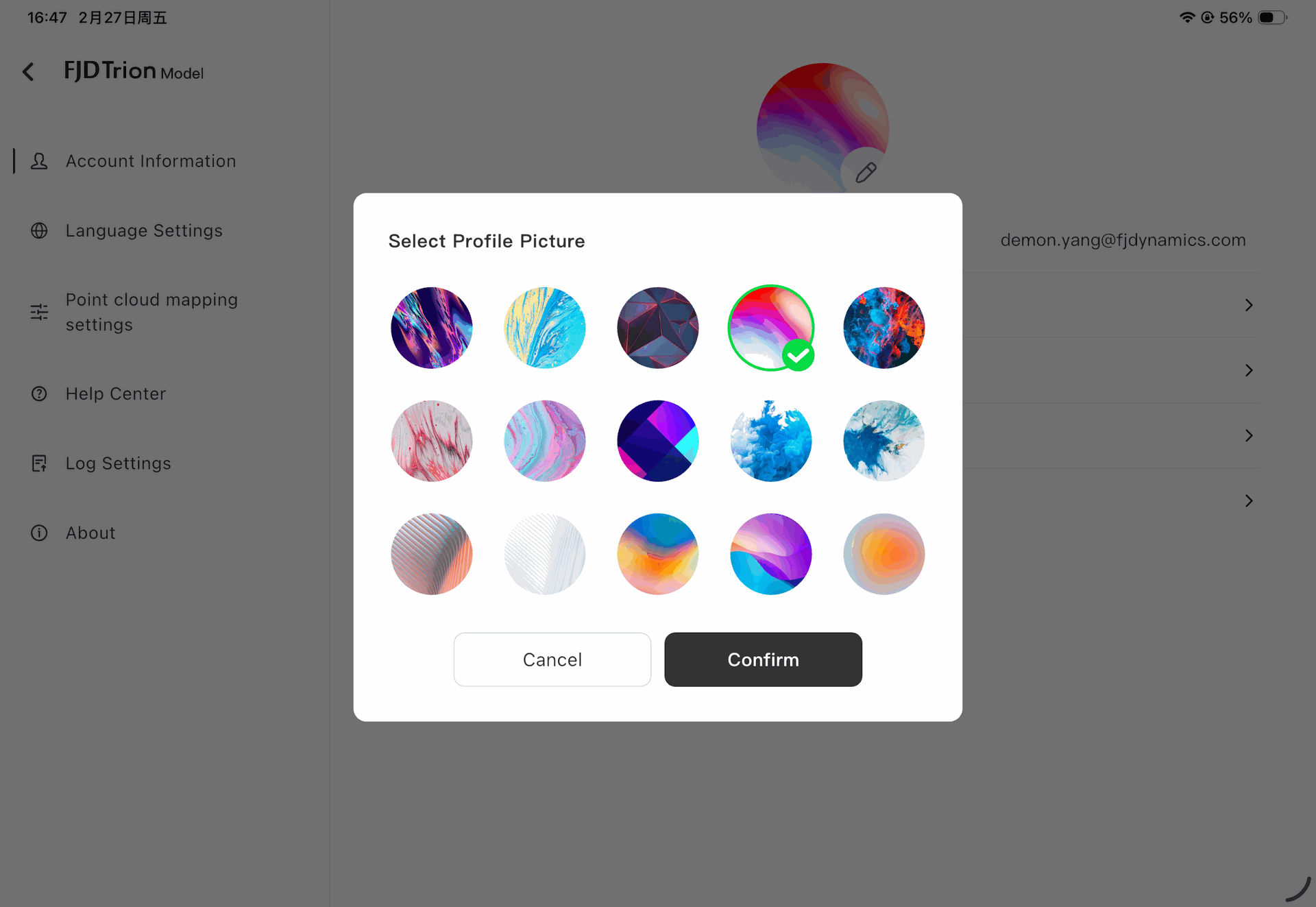
1. User Avatar Settings
- Adds support for setting different default user avatars.
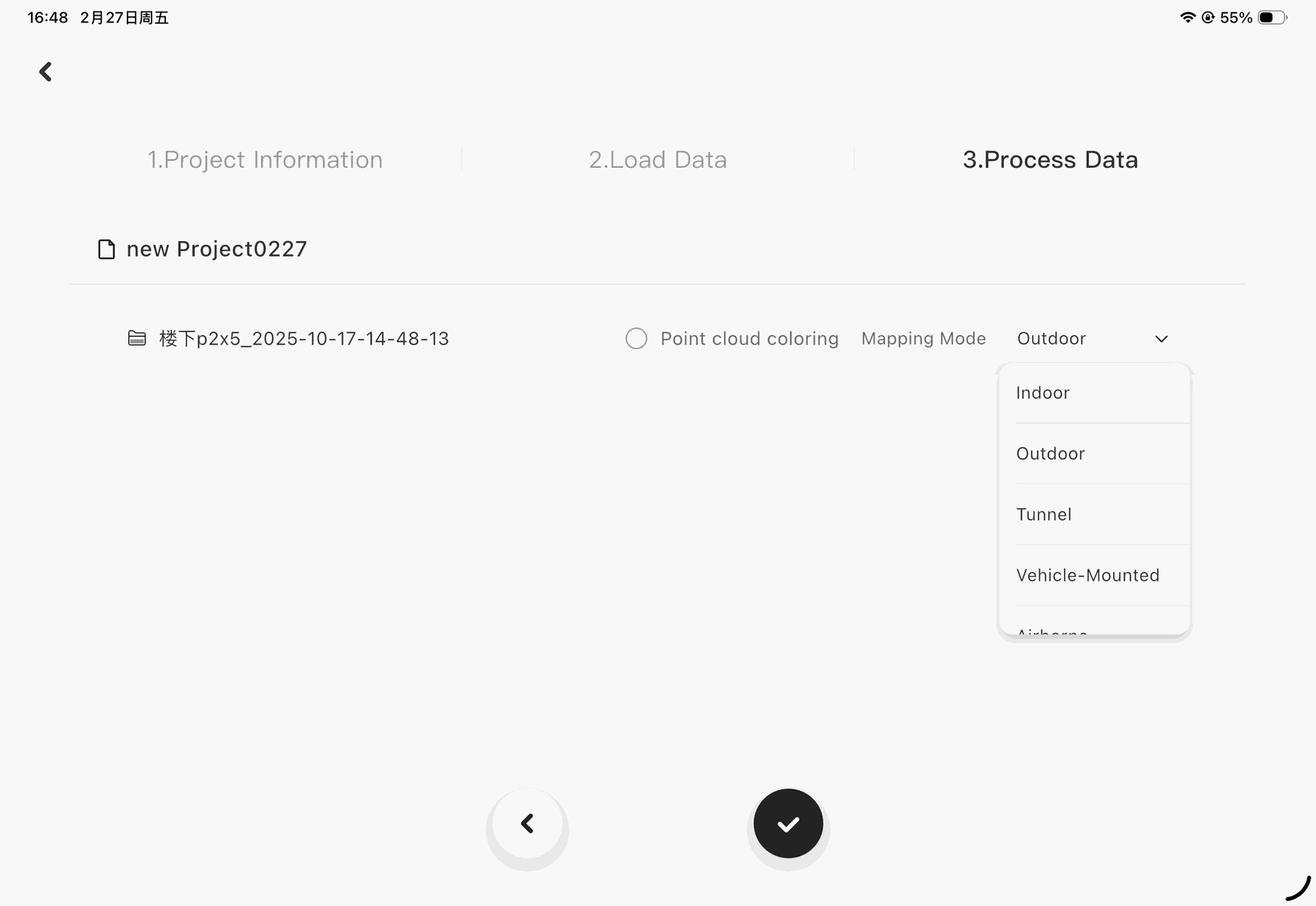
2. Mapping Mode Configuration
- Enables selection of mapping modes for different device models to achieve higher-quality point cloud data.
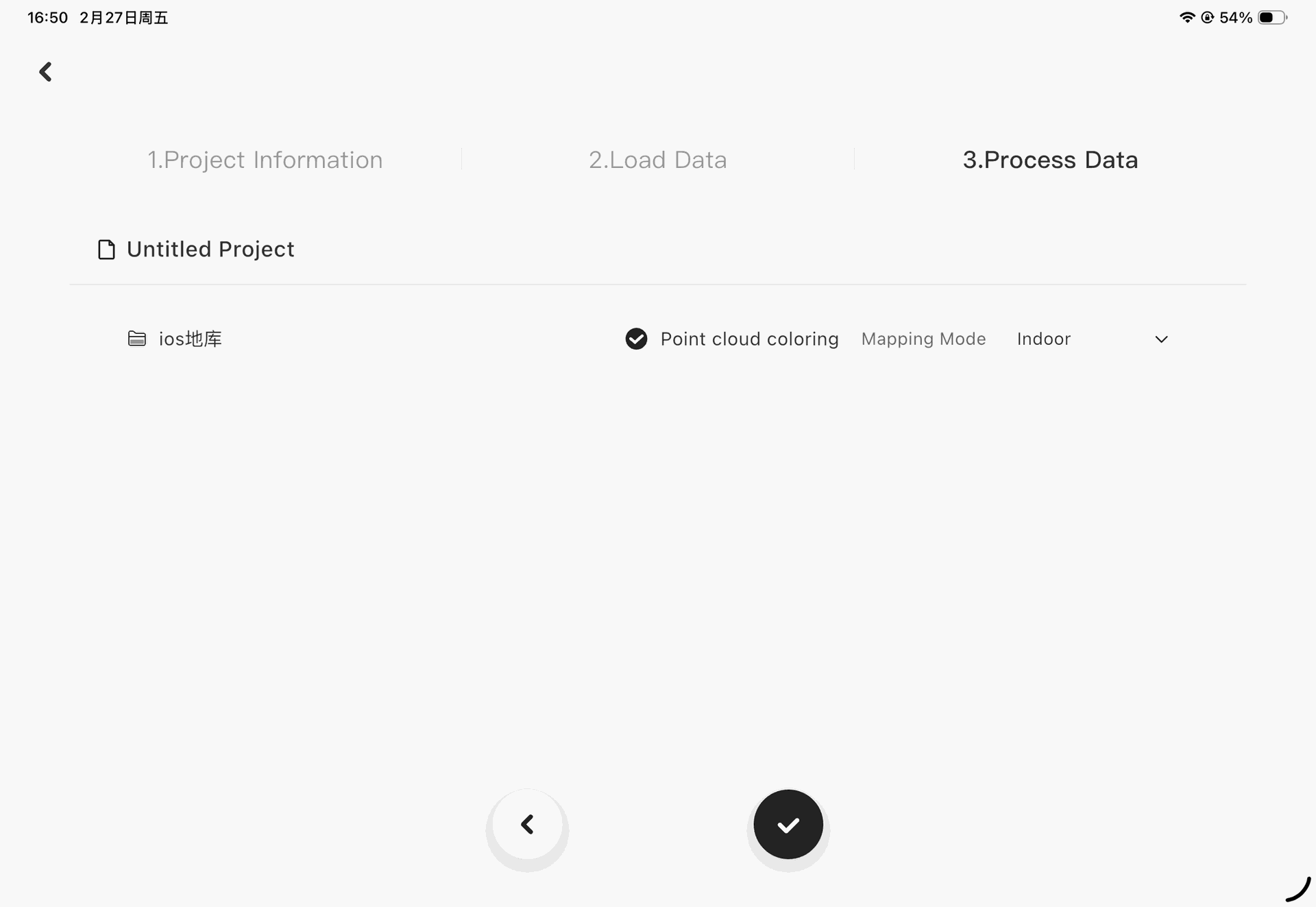
3. iOS V4e LiDAR Colorization
- Supports colorization of data collected on iOS devices (Android support not available).
- Automatically analyzes scan data to determine colorization availability without user intervention.
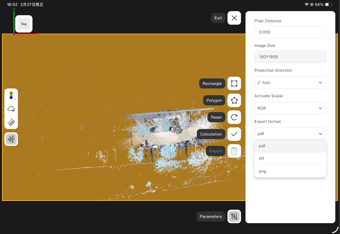
4. Orthophoto Output Optimization
- Adds support for exporting orthophotos in *.tiff and *.png formats.
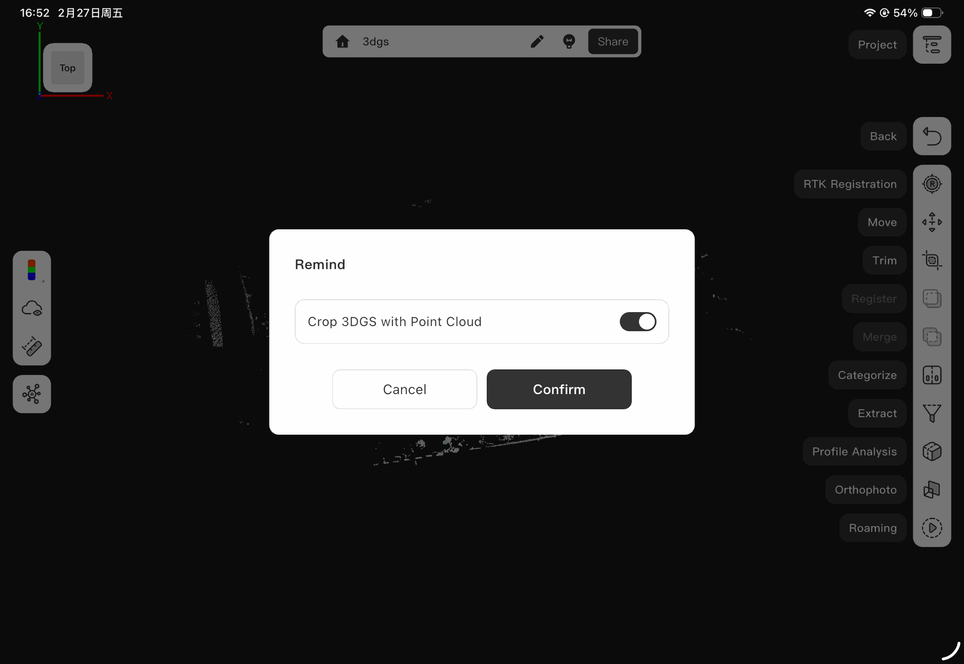
5. 3DGS Data Cropping
- Enables simultaneous cropping of point cloud and 3DGS model data.
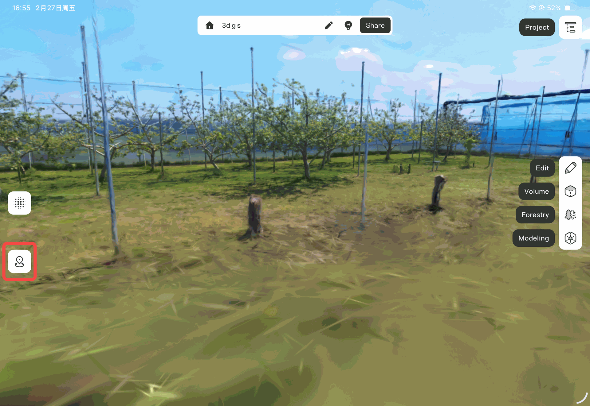
6. Gaussian Data Viewer Enhancement
- Adds “Return to Start Point” button for quickly locating the initial position.
II. Improvements
1. Forestry Tree Calculation
- Optimizes per-hectare tree estimation logic for more accurate results.
2. Trajectory Display in Fusion Viewer
- Improves trajectory display to reduce clutter and enhance navigation clarity.
